")
Last updated on November 18th, 2025 at 11:49 am
South Australian Resources Information Gateway
South Australian Resources Information Gateway is an online mapping tool provided by the Government of South Australia, which contains a range of information about the State’s natural resources. It is available for the general public to use to learn and understand more about the physical environment.
SARIG is an initiative of the Government of South Australia that provides access to over 130 years of South Australian minerals, petroleum and geothermal geoscientific information in an interactive online mapping format (SARIG | Description).
Information about the physical environment is stored in data layers which appears in the menu bar on the left side of the online tool. By selecting layers and choosing a location, related information is presented in map format. One useful layer shows active mining tenements: Mineral Tenement Production layer.
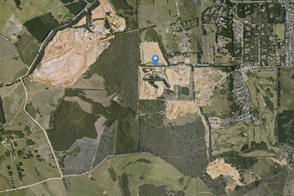
Case study in understanding the sandmines around Mount Compass
Using SARIG, selecting Mount Compass, you can visualise the community and surrounding sandmine excavation evidenced in the image on the left. By applying the Mineral Tenement Production layer, it reveals both the current sandmines being exploited as well as retention leases.
Mount Compass and surrounding sandmine activity
The brown scars to the west of Mount Compass (seen to the right) show sandmining activity.
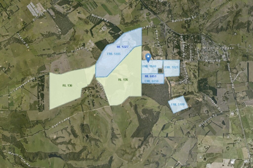
Applying the Mineral tenement production layer
The Mining Tenement Production layer, when applied, reveals the Extractive minerals leases (EML), Mineral leases (ML), and Retention leases (RL). EML and ML leases are show active sandmining. RL refer to leases which can potentially be exploited. See Types of mining tenure for definitions of tenure types.
Mining Register Search – Tenements
https://mers.dem.sa.gov.au/mining-register/search-tenements
The Mining Register is a database which stores information about mining tenements. It is part of the Mining Exploration and Regulation System (MERS).
The new portal provides a modern digital platform to better meet the needs of community, industry and the department, streamlining regulatory processes, improving user experience, and supporting efficient interactions between industry and government. (Government of South Australia | Mining Exploration and Regulation System (MERS).
How to use the tenement register
You can use the database to look up the operators of the tenements. In the case of Mount Compass, the following tenements are listed in the register (as of 9 November 2025):
| Tenement code | Company owning the licence |
| ELM 5521 | Sand and Loam Pty. |
| ELM 5199 | Sand and Loam Pty. |
| ELM 6450 | Sand and Loam Pty. |
| ELM 5540 | Springvale Estates Pty Ltd |
| ELM 5465/ML 5327 | Holcim (Australia) Pty Ltd. |
| RL 136 | Holcim (Australia) Pty Ltd. |
| RL 135 | Holcim (Australia) Pty Ltd. |
Each Tenement Registry entry, contains details about the tenement contract. Additionally, using Australian Business Register, it is possible to find out more detail about the operators which are mining sand in Mount Compass.
References
- Government of South Australia 2023, Sarig Map, viewed on 7 April, 2023, <https://map.sarig.sa.gov.au>. This graphical search tool allows tenement searches.
- Australian Government 2023, Current details for ABN 76 460 256 930, viewed on 7 April, 2023, <https://abr.business.gov.au/ABN/View?abn=76460256930>. This is the ABN listing for The trustee for Mt Compass Sand & Loam Unit Trust.
- Australian Government 2023, Current details for ABN 87 099 732 297, viewed on 7 April, 2023, <https://abr.business.gov.au/ABN/View?abn=87099732297>. This is the ABN listing for Holcim (Australia).
- Government of South Australia 2023, Current details for ABN 79 007 742 958, viewed on 7 April, 2023, <https://abr.business.gov.au/ABN/View?abn=79007742958>. This is the ABN for Springvale Estates Pty.
- Government of South Australia 2023, Glenshera Sand Glass Mine, viewed on 7 April, 2023, <https://www.energymining.sa.gov.au/industry/minerals-and-mining/mining/major-projects-and-mining-activities/major-operating-quarries/glenshera-sand-mine>. This page provides information about the Glenshera mining operation, which is listed as a major mine.
- Government of South Australia 2025, Mining Register Search – Tenements, viewed on 7 April, 2023, <https://mers.dem.sa.gov.au/mining-register/search-tenements/>. This page operates as an interface to the Mining Register database.