
Last updated on June 17th, 2026 at 10:35 pm
The Swamps of the Fleurieu Peninsula are localised wetlands occurring in high rainfall areas in the local catchment areas of Tookayerta, Hindmarsh, Parawa, Myponga, Yankalilla, Onkparinga, Currency Creek and Finniss. They are densely vegetated and occur adjacent to waterlogged soils around low-lying creeks and flats. The Swamps are typified by their reedy or heathy vegetation growing on peat, silt, peat silt, or black clay soils.
Australian Government | Swamps of the Fleurieu Peninsula
The Australian Government under the Environment Protection and Biodiversity Conservation Act 1999 (EPBC Act) has identified the Swamps of the Fleurieu Peninsula as a critically endangered eco-system.
This ecological community is eligible for listing as critically endangered under the Environment Protection and Biodiversity Conservation Act 1999 (EPBC Act) on 21 March 2003 as, the Minister considered the Threatened Species Scientific Committee’s (TSSC) advice and amended the list under section 184 to include the Swamps of the Fleurieu Peninsula ecological community.
Australian Government | Approved Conservation Advice for the Swamps of the Fleurieu Peninsula ecological community
The Commonwealth published the Approved Conservation Advice for the Swamps of the Fleurieu Peninsula ecological community in 2013, which highlighted the threats to the swamp eco-systems owing to fragmentation because of private land use patterns. These swamps had been drained thereby losing the moisture to sustain native species and making the landscape susceptible to native and non-native invasive species.
NatureMaps view of the swamps around Mount Compass
NatureMaps is an online mapping tool which contains a range of information about the South Australia’s environmental resources. It is available for the general public to use to learn and understand more about the physical environment. (TheMissingLibrary | NatureMaps)
Activating the layers: Wetland Inventories and the Wetlands of National Importance, NatureMaps displays the swamps across the Fleurieu as well as those identified as nationally important. In the graphic below, you can see the vast network of swamps which reside in the lowland pockets across the landscape between Myponga and Mount Compass. The swamps of national importance are identified by diagonal bar stripes. These include the Stipiturus (Glenshera Swamp) Conservation Park and the Hesperilla Conservation Park.
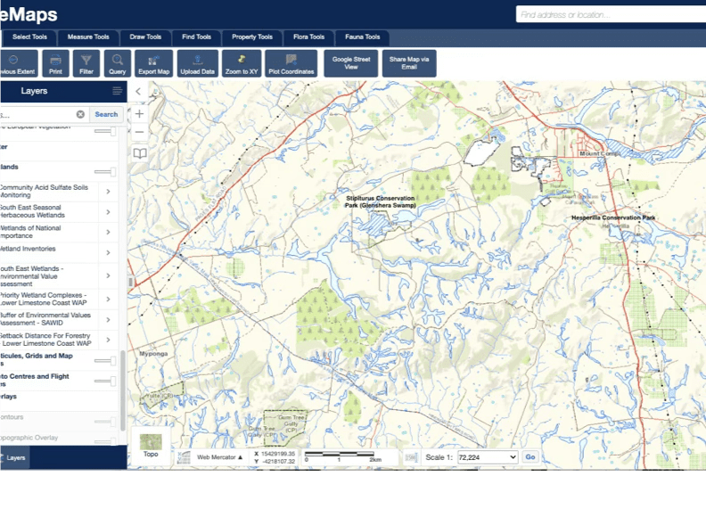
The swamps sit at the foot of the surrounding hills such as Mount Compass, where the water travels through Permian sands to reach the Mount Compass School swamp (as shown in the graphic below), another nationally recognised wetland which is situated near the school south of Arthur and Victor Harbor roads. Many of the swamps were originally connected such as those along the Tookayerta and Finniss Catchment which drains the areas south of Mount Compass in the direction of the Murray river.
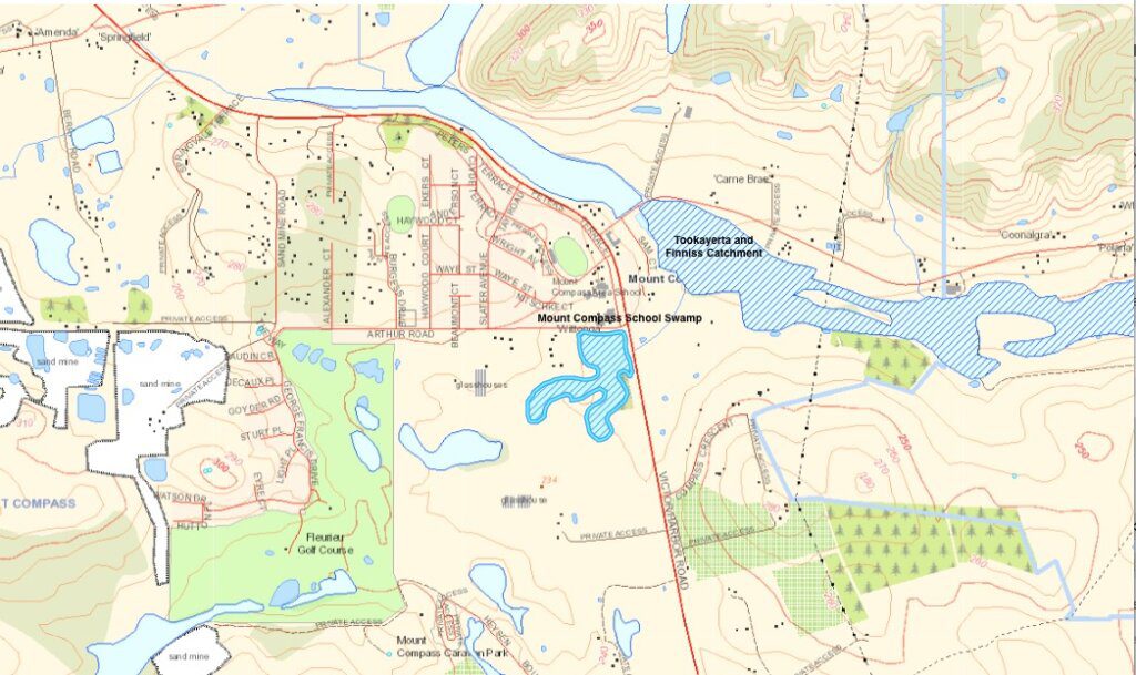
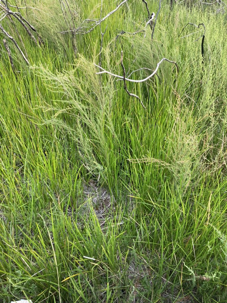
Mount Compass school swamp
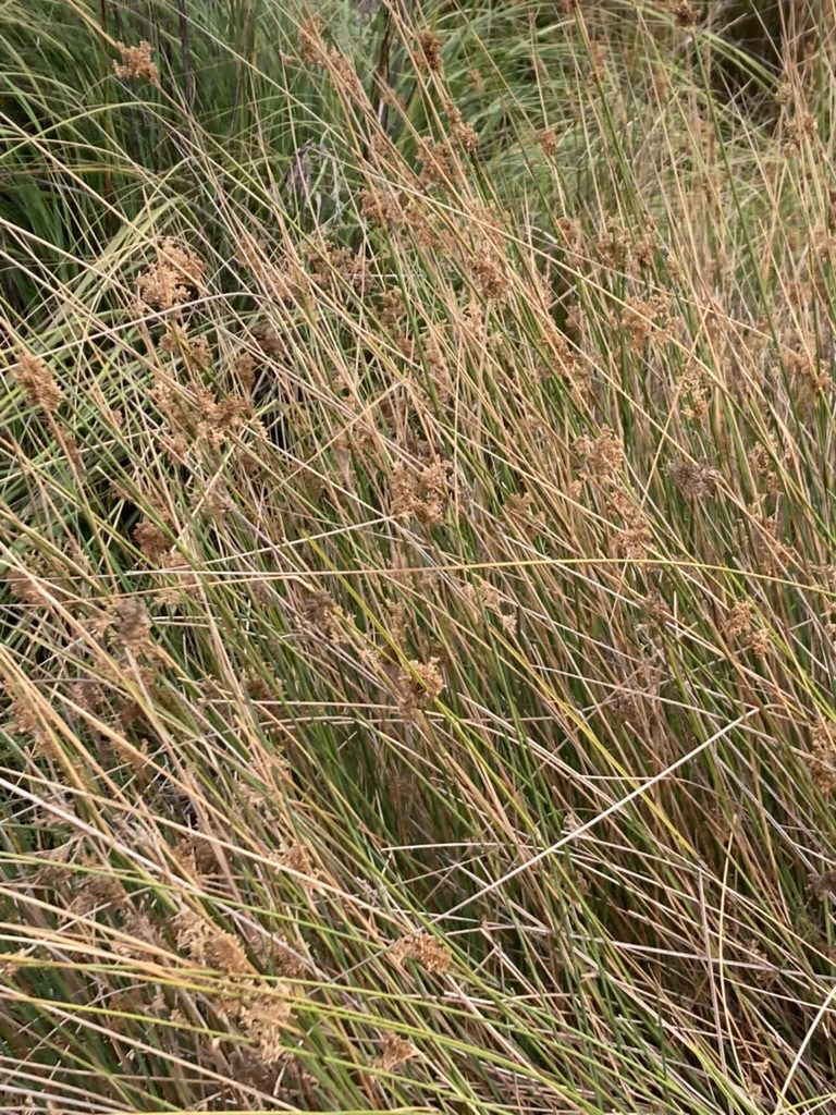
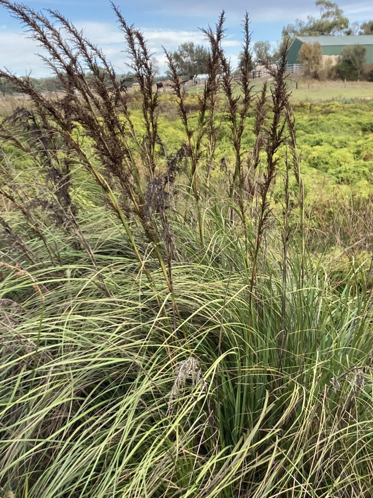
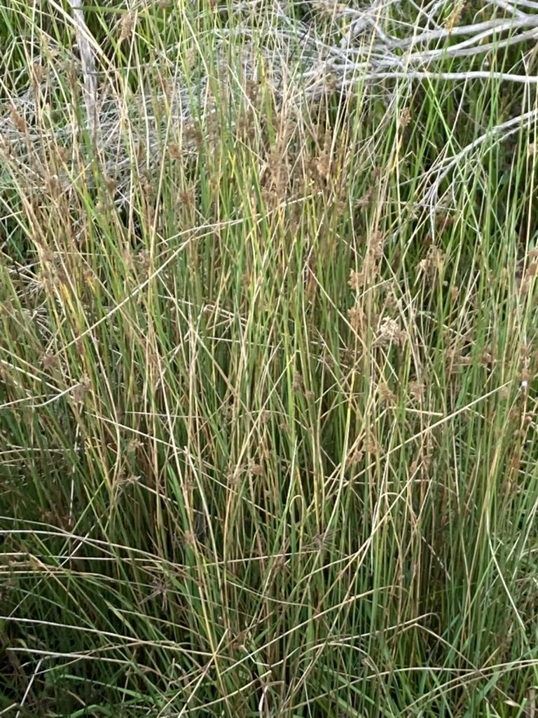
Significant vegetation within a Fleurieu Swamp
Parks of the Central Fleurieu
As of 2023, there are Central Fleurieu Peninsula Parks 15 parks and/or reserves. The central cluster of these include the Hesperilla Conservation Park (11 ha) and the Stipiturus Conservation Park (68 ha) are some of the newest to be added.
Stipiturus and Hesperilla conservation parks are situated low in the landscape and are thought to be predominantly underpinned by the Permian Sands aquifer. However, seasonal surface flows and local seepage are thought to also have some influence on inundation in these swamps. Less than 20% of the wetlands of the Fleurieu Peninsula are considered to be Permian Sands wetlands (Barnett and Rix 2006).
Stipiturus Conservation Park contains part of what is known as ‘Glenshera Swamp’. It is the largest remaining intact peat swamp ecosystem on the Fleurieu Peninsula. Over half of the native plants found in and around the swamp have regional and state conservation significance. Stipiturus and Hesperilla conservation parks are important for protecting swamp-based populations of the nationally endangered Mount Lofty Ranges southern emu-wren.
Government of South Australia | Parks of the Central Fleurieu Peninsula Management Plan
Restoration work begins on Glenshera swamp in Stipiturus Conservation reserve
In 2015, the Nature Glenelg Trust (NGT) became involved in a project to restore the Glenshera Swamp which resides in the Stipiturus Conservation reserve. This 18 minute video (2016) by Mark Bachmann of NGT presents information on options for developing hydrological restoration options.
Fabulous Fleurieu Swamps – Stipiturus Conservation Park
This 5 minute video discusses the ongoing efforts by the Landscapes Fleurieu and Hills in partnership with the Nature Glenelg Trust and the newly established Friends of the Stipiturus Conservation Park.
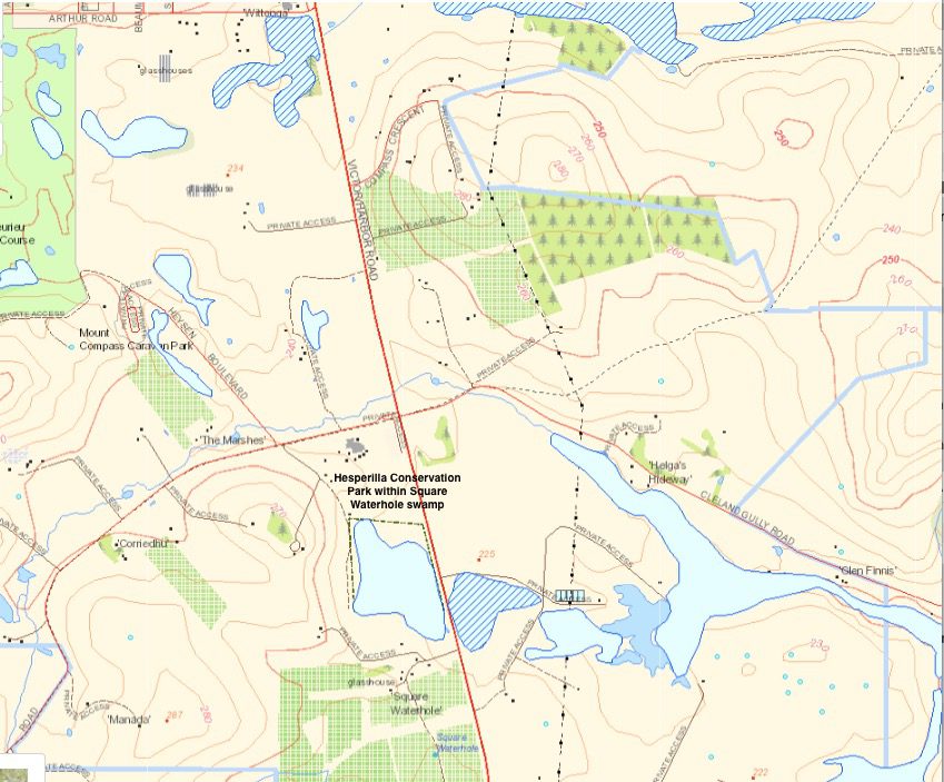
Restoration of the Squarehole Swamp at Hesperella Conservation Park
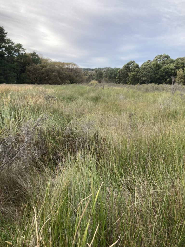
Another project included in the Management Plan is for the restoration of the Square Waterhole Swamp through the establishment of the Hesperilla Conservation Park, one of the newest parks to be added to the Fleurieu. This swamp is situated next to Victor Harbor road below Mount Compass as shown in the graphic below:
The restoration work was carried out by the Nature Glenelg Trust over several years. Mark Bachmann (2023) and Ben Taylor (2024) discuss the restoration process and the outcome a year later to the Hesperilla Conservation Park in the following webpages:
- Peatland restoration update: first glimpse of the latest works to rehydrate Fleurieu Peninsula swamps (Bachmann, M 2024)
- Healing a critically endangered swamp – Hesperilla conservation park one year later (Taylor, B 2024)
Some observations made by citizen scientists in Hesperilla Conservation Park in inaturalist
Some of the flora and fauna, specifically insects, in Hesperilla Conservation Park, which have been recorded through photos taken by citizen scientists. Click on the webpage: iNaturalist 2019 | Hesperilla Conservation Park, SA, AU.
References
- 30 years of Fame 2023, Mount Lofty Southern Emu-Wren, viewed on 18 January, 2024, <https://www.fame.org.au/assets/emu-wren-beca87d4-9024-40c5-9750-28fd001d3b3-resize-750.jpeg>. This is an image of a Mount Lofty Southern Emu-Wren.
- Australian Government 2013, Approved Conservation Advice for the Swamps of the Fleurieu Peninsula ecological community, viewed on 18 January, 2024, <https://www.environment.gov.au/biodiversity/threatened/communities/pubs/031-conservation-advice.pdf>.This PDF provides conservation advice for the Swamps of the Fleurieu Peninsula including identifying the major threats.
- Australian Government 2023, Swamps of the Fleurieu Peninsula, viewed on 18 January, 2024, <https://www.dcceew.gov.au/sites/default/files/documents/fleurieu-swamps.pdf>. This 2 page PDF provides information about the recovery programme for the Swamps of the Fleurieu Peninsula.
- Bachmann, M 2016, Developing hydrological restoration options for Glenshera Swamp, Stipiturus Conservation Park, viewed on 18 January, 2024, <https://youtu.be/BMB86–23Uo?si=h2P_na5eeZXfBSyg>. This 18 minute video provides information about the proposal to restore the Glenshera Swamp at the Stipiturus Conservation Park.
- Bachmann, M 2023, Peatland restoration update: first glimpse of the latest works to rehydrate Fleurieu Peninsula swamps, viewed on 18 January, 2024, <https://natureglenelg.org.au/peatland-restoration-update-first-glimpse-of-the-latest-works-to-rehydrate-fleurieu-peninsula-swamps/>. This article discusses the rehabilitation of swamps including the Hesperilla swamp south of Mount Compass near Gully Rd.
- Government of South Australia 2023, Parks of the Central Fleurieu Peninsula Management Plan 2023, viewed on 18 January, 2024, <https://cdn.environment.sa.gov.au/environment/docs/FINAL_Parks-of-the-Central-Fleurieu-Peninsula-Management-Plan-2023.pdf>. This PDF is the approved management plan for the parks of the central fleurieu peninsula 2023.
- Government of South Australia 2022, Fabulous Fleurieu Swamps – Stipiturus Conservation Park, viewed on 18 January, 2024, <https://youtu.be/hxBOM6q82Ig?si=PpiOsX1fWFNTB_m0>. This 5 minute video discusses the ongoing efforts by the Landscapes Fleurieu and Hills in partnership with the Nature Glenelg Trust and the newly established friends of the Stipiturus Conservation Park.
- iNaturalist 2019, Hesperilla Conservation Park, SA, AU, viewed on 18 January, 2024, <https://www.inaturalist.org/places/hesperilla-conservation-park#>. Some of the flora and fauna, specifically insects, in Hesperilla, which have been recorded through photos taken by citizen scientists.