Last updated on October 30th, 2026 at 09:45 pm
Libguide
The Planning, Development and Infrastructure Act, 2016 is the South Australian legislation which defines the terms by which building development occurs in South Australia. the Act is maintained by the Ministry of Planning.
The preface states that it is:
An Act to provide for matters that are relevant to the use, development and management of land and buildings, including by providing a planning system to regulate development within the State, rules with respect to the design, construction and use of buildings, and other initiatives to facilitate the development of infrastructure, facilities and environments that will benefit the community.
Division 2, Section 48 of the Act defines a web-based planning portal for making information and process available to the South Australian public. This part of the Act is manifested in PlanSA, the website containing information and online tools for the long term planning and development of South Australia.
Planning Zones
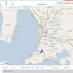
For the purpose of managing land development through the use of planning policy, planning and development zones are an important part of defining how land can be used. The zones are defined in the PlanSA: Guide to the Planning and Design Code, which is included in the PlanSA information portal. In combination with the the South Australian Property and Planning Atlas (SAPPA), a free online web based tool for viewing planning zones within a physical area such as a town or township, it is possible to learn what zones are applied to a given community.
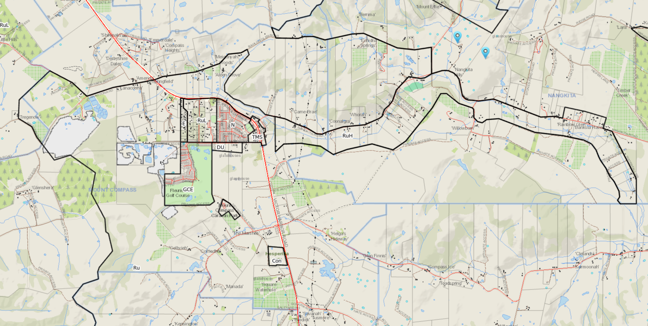
This libguide lists the current zoning for the Mount Compass including the Tookayerta catchment.
Zones in the town of Mount Compass
Small communities such as Mount Compass have a range of zones to define planning and regulation in a given area. These zones apply to areas which are predominently for commercial and those which are for residential use.
Township Main Street (TMS) Zone
The Township Main Street zone consists of the land on both sides of Victor Harbor Rd. including the shopping centre, the commercial stores on the east side, as well as the commercial and community buildings such as the Community Hall, the CFS fire station, the opportunity shop and Mount Compass school on the west side.
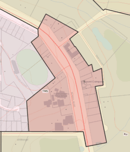
This planning zone is defined by the planning code as follows:
This zone provides a focus for regional main streets that service the local community and visitors. Development will primarily comprise retail, office, entertainment and recreational land uses and activities. Housing may be accommodated in conjunction with non-residential uses, ideally sited above or behind nonresidential uses to ensure shopfronts on the main street are preserved. Buildings complement the traditional low-scale main street character with ground floor uses that contribute to an active and vibrant street may be appropriate.
Where it applies
The zone applies to town centres that are focussed around a traditional main street. p. 77
Neighbourhood Zone
This part of Mount Compass which is within the neighbourhood zone is bounded by Victor Harbor road to the north-east, the housing which runs along Eckers road to the west, and Arthur road to the south.
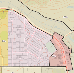
This planning zone is defined by the planning code as follows:
This zone encourages housing that supports a range of needs and complements the existing local context. Services and community facilities contribute to making a convenient place to live without compromising the residential amenity and character of the neighbourhood.
Where it applies
The zone is generally applied to the residential areas of country townships.
p. 50
Rural Living (RuL) Zone
The Rural Living zone is bounded by the Neighbourhood zone and the Employment zone, which borders Sandmine Rd. The zone contains the Burgess Cricket Oval and large residential properties, some of which have vestiges of the original Brown Stringybark woodland.
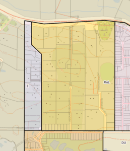
This planning zone is defined by the planning code as follows:
This zone envisages a spacious, secluded and peaceful residential lifestyle within semi-rural or semi-natural environments, providing opportunities for a range of low-intensity rural activities and home-based business activities that complement that lifestyle choice. Ancillary land uses, such as small-scale animal keeping, will be of a scale and type that will not interfere with the residential function of the land or adjoining land, or the semi-rural character desired for the zone. Allotments will be of a size capable of supporting hobby rural activities such as horse keeping, small-scale horticulture and small-scale businesses.
Where it applies
To rural areas where dwellings are anticipated along with farming.
Subzones
The zone includes two subzones:
Animal Husbandry Subzone
Applies to locations where large-scale horse keeping and dog kennelling occur in association with residential development.
Intensive Horse Establishments Subzone
Envisages the accommodation of a range of commercial horse-related activities primarily for the agistment of horses, their breeding, stabling and training in association with residential development.
p. 60
Golf Course Estate (GCE) Zone
The Golf Course Estate zone emcompasses the Mount Compass Golf course and the residential development which runs along Arthur Rd., George Francis Drive and its extension: Watson Drive. There are a number of cul-de-sacs which run off George Francis Drive. The zone is bounded by sandmine operations to the west and south of the estate.
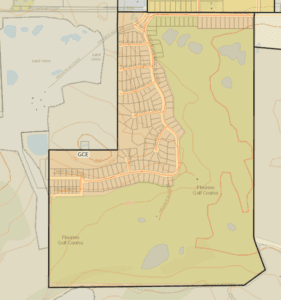
This planning zone is defined by the planning code as follows:
This zone envisages a golf course and associated club facilities as well as housing and tourism development sensitively integrated with natural features such as topography, vegetation and watercourses. Services and facilities support recreation and tourism. Dwellings on sites/allotments that overlook the golf course are designed to take advantage of golf course views while providing attractive frontages to public streets. Where it applies To golf courses and adjoining residential estates. Subzones None.
p. 59
Employment (E) Zone
The Employment zone is a long strip which extends along Sandmine Rd. facing the Rural Living zone. Much of the businesses located along this trip include a rural engineering operation, a manufacturer of rainwater tanks, auto body, firewood sales, and commercial storage. It is a large area making it ideal of other industries which may improve the employment opportunities of the surrounding population.
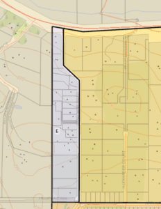
This planning zone is defined by the planning code as follows:
This zone supports a diverse range of low-impact, light industrial, commercial (including bulky goods) and business activities that complement the role of other zones with significant industrial, shopping and business activities.
Where it applies
The zone applies to areas with a mix of industrial and commercial land uses, including large-format retail showrooms.
Subzones
The zone includes 2 subzones:
Roadside Service Centre Subzone
Seeks provision of services and facilities to cater for the needs of road users, particularly on long journeys.
Retail Activity Centre Subzone
Applies to specialist activity centres that comprise large format retail and commercial activities which complement the principal land uses desired in the zone and the role of other zones accommodating significant shopping, business and commercial activities.
Deferred Urban (DU) Zone
The Deferred Urban zone occupies a parcel of land to the south of Arthur Rd bounded by the Golf Course on the west and the Neighbourhood zone to the north. The land to the south is part of the Rural zone and is is bordering wetlands.
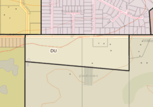
This planning zone is defined by the planning code as follows:
This zone allows for a limited range of low-intensity land uses and activities needed to support the existing use of the land without impeding the ability of the land to be developed for alternative forms of urban development in the future.
Where it applies
To areas reserved for future development.
p. 107
Caravan and Tourist Park (CTP) Zone
The Mount Compass Caravan Park provides cabins, caravan and camping sites for tourists as well as permanent residents.
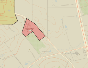
This planning zone is defined by the planning code as follows:
Zone outcome This zone supports caravan and camping sites, cabins, transportable dwellings and their associated services and facilities. It primarily caters for short-term residents and visitors.
Where it applies
The zone applies to caravan parks.
p. 81
Zones in the Mount Compass township
Most of the area of Mount Compass township is listed as within the rural zone. This includes dairies and beef farms but it also includes extractive activity such as sandmines. There are three active sandmine operations within the Mount Compass township. There is also a sandmine operation at Tooperang.
Rural (RU) zone
Mount Compass is surrounded mostly by land which is zoned Rural (Ru). This area covers dairy and beef production as well as extractive operations involving sandmining. There are presently three active sandmine operations as well as a fourth operation in Tooperang.
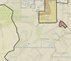
This zone covers the majority of the incorporated areas of the state. It supports a wide range of primary production activities and provides opportunities for value-adding and the use of renewable energy sources, including wind/solar farms.
Where it applies
The zone applies to vast areas of land between rural towns.
p. 82
Rural Horticulture Zone
Horticulture was very much a part of the farming activity in the past. There remains some horticultural activity along Nangkita creek. The image below displays the lots which extend along the Nangkita creek towards the fork connection of Tookayerta creek.
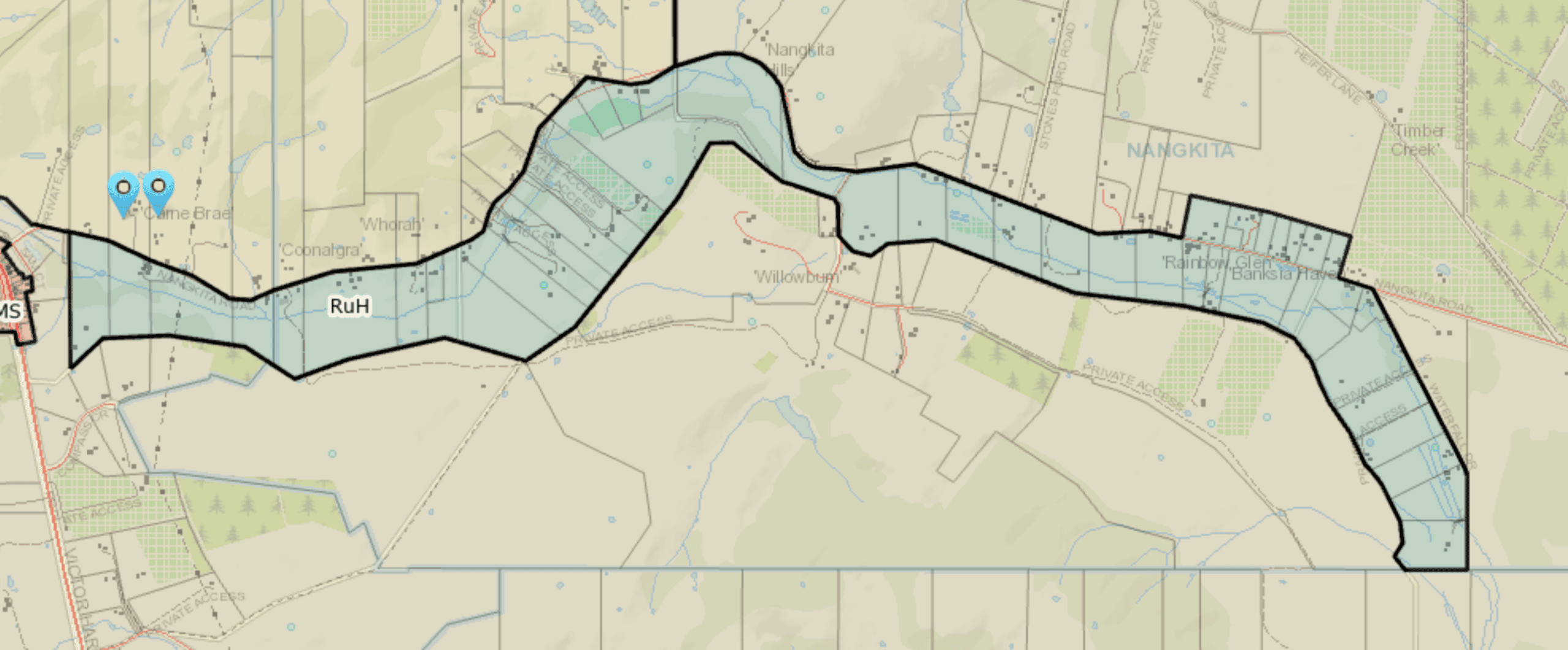
This zone provides for intensive agriculture in the form of growing and processing of produce while supporting a wide range of low-impact rural activities. Value-adding opportunities are envisaged, with less emphasis given to tourist accommodation.
Where it applies
The zone applies to areas used for horticulture, such as the Riverland.
p. 82
Productive Rural Landscape Zone
The areas within this zoning include market gardening, forest farming, poultry operations, as well as dairy and beef production.
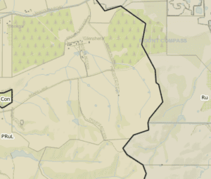
This
This zone supports a complex and diverse range of land uses at the appropriate scale and intensity needed to conserve and enhance the zone’s natural character, biodiversity, identity and scenic qualities.
Where it applies
The zone applies to the Mount Lofty Ranges in the Adelaide Hills region.
Subzones
The zone includes one subzone:
The Cedars Subzone
Envisages a cultural, arts and tourist precinct centred on the former residence and studio of artist Hans Heysen and conservation of the surrounding eucalypt forest.
pp. 81-82
Conservation Zone
This zone defines areas which have been set aside for conservation purposes. The conservation zone includes the Hesperilla conservation park, Stipiturus conservation park. Interestly, the Mount Compass School swamp does not have conservation zoning.
The image below shows the conservation zoning of the Hesperilla conservation uni
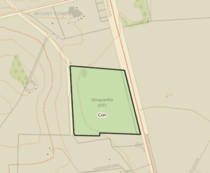
This zone seeks the conservation and enhancement of the natural environment and natural ecological processes for their historic, scientific, landscape, habitat, biodiversity, carbon storage and cultural values. It includes provision of opportunities for the public to experience these through low-impact recreational and tourism development. It provides for a limited mix of development/land uses, including signage related to conservation and tourist information, small-scale recreational facilities/amenities, camp grounds and structures for conservation purposes.
Where it applies
Conservation parks and reserves under state and federal government ownership, and privately owned land where coastal or riverine processes occur, and includes areas of protected scrub, lakes, etc.
pp. 90-91
Related topics
South Australian Planning Portal Application (SAPPA)
Reference
- Government of South Australia 2023, Planning, Development, and Infrastructure 2016 Act, viewed on 11 August, 2023, <https://www.legislation.sa.gov.au/lz?path=%2FC%2FA%2FPlanning%20Development%20and%20Infrastructure%20Act%202016>. This page provides links to the current as well as past forms of the Planning, Development and Infrastructure Act as well as Gazette references.
- Government of South Australia 2026, PlanSA: Guide to the Planning and Design Code, viewed on 30 September, 2026, <https://plan.sa.gov.au/__data/assets/pdf_file/0010/799939/Guide_to_the_Planning_and_Design_Code.pdf>. This 128 page PDF provides broad definitions of the planning zones for South Australia.
- Government of South Australia 2026, PlanSA, viewed on 11 August, 2023, <https://plan.sa.gov.au/>. This is the official website for the ministry of Planning, a department of the Government of South Australia.